If you’re eyeing a trip to Iceland and want to do more than just snap photos of glaciers, this Krossárjökull Glacier Mapping Adventure offers a fascinating blend of exploration and contribution. This tour, run by Gravel Travel, isn’t your typical sightseeing experience; it’s a chance to step into the shoes of a Citizen Scientist while exploring some of Iceland’s less-visited natural wonders.
What really sets this experience apart? First, we love how it combines adventure with purpose—you’re not just looking at glaciers from a distance but actively helping monitor their health. Second, the stunning drive through Thorsmork and the chance to hike into a secluded canyon make it a visually impressive outing.
That said, the tour isn’t for everyone; it involves some moderate physical activity, and it’s best suited for those comfortable with outdoor adventures.
One thing to consider is that the tour lasts around 10 hours, which can be a long day if you’re not used to full-day excursions. And since it’s a scientific-focused experience, group sizes are limited to keep guidance personalized, so booking early is smart.
This adventure is perfect for travelers who are curious about climate change, enjoy outdoor activities, and want an experience that feels meaningful. If you’re looking for a unique, educational trip that combines Iceland’s wild beauty with a chance to make an impact, this could be just the ticket.
Key Points
- Active contribution: You’ll help monitor the glacier’s condition as part of a Citizen Scientist program.
- Stunning landscapes: The drive through Thorsmork and hike into the canyon offer remarkable scenery.
- Moderate hiking: Expect a 1-1.5 hour trek each way through a remote canyon, suitable for those comfortable with physical activity.
- Expert guidance: Knowledgeable guides provide both safety instruction and insights into glacier science.
- All-inclusive: Includes transportation, equipment, and a certificate, making it a convenient full-day experience.
- Limited group size: Ensures personalized attention and guidance, but requires early booking.
👉 See our pick of the The Top 2 Vik Walking Tours
What to Expect on the Tour
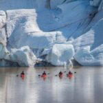
This isn’t your average glacier trip. Starting from Hvolsvöllur, you will be whisked away in a comfortable 4×4 vehicle through the iconic Icelandic highlands toward Thorsmork. Think vivid volcanic landscapes, glacier-fed rivers, and striking mountain backdrops—this drive alone is worth it.
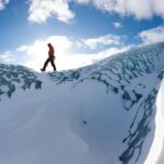
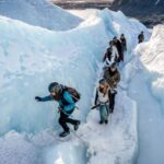
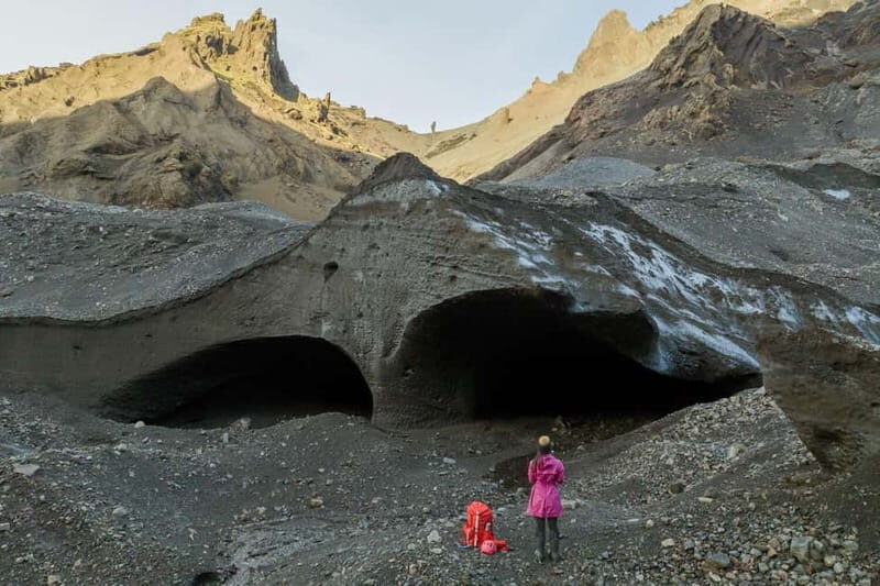
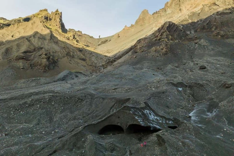
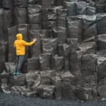
Once in Thorsmork, your adventure truly begins with a scenic hike into a secluded canyon that’s off the usual tourist trail. The canyon trek is considered moderate—taking about 1-1.5 hours each way—and is designed to bring you far from crowds into a quiet, untouched natural setting. The trail features varied terrain, so comfortable hiking shoes and outdoor clothing are a must.
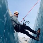
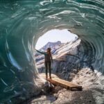
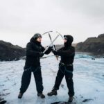
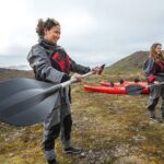
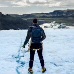
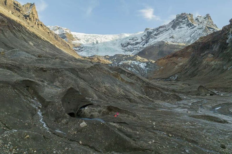
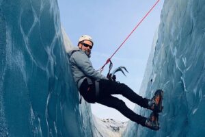
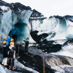
After reaching Krossárjökull Glacier, you’ll get an up-close look at one of Iceland’s lesser-known glaciers. Guides will give a safety briefing and teach you how to use the mapping equipment, which is part of a Citizen Scientist program aimed at monitoring glaciers. As you walk around, you’ll encounter surreal ice formations and learn how glaciers like Krossárjökull are indicators of climate change.
The real thrill? Your participation in mapping the glacier’s terrain. With the help of expert guides, you’ll record data that contributes to ongoing research—turning what might seem like just a walk into a meaningful scientific activity. Afterward, you’ll enjoy a packed lunch amid the breathtaking views, soaking in the scenery and hearing stories about the glacier’s history and its importance within Katla Geopark.
You can also read our reviews of more tours and experiences in Vik.

The Scenic Drive and Hike
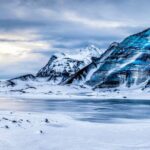
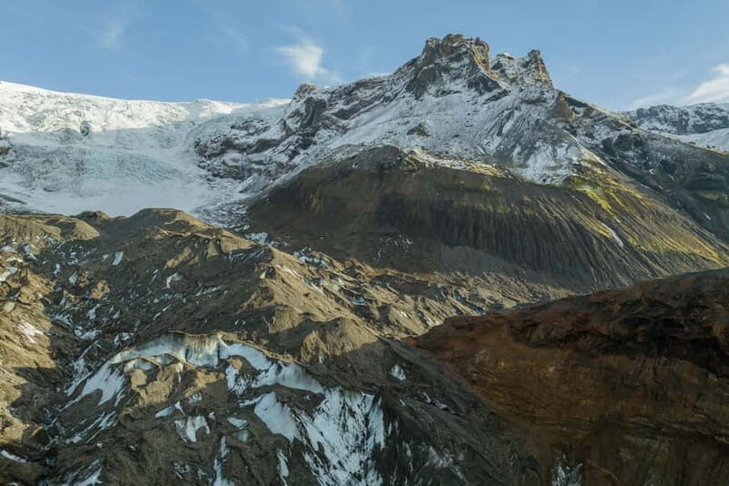
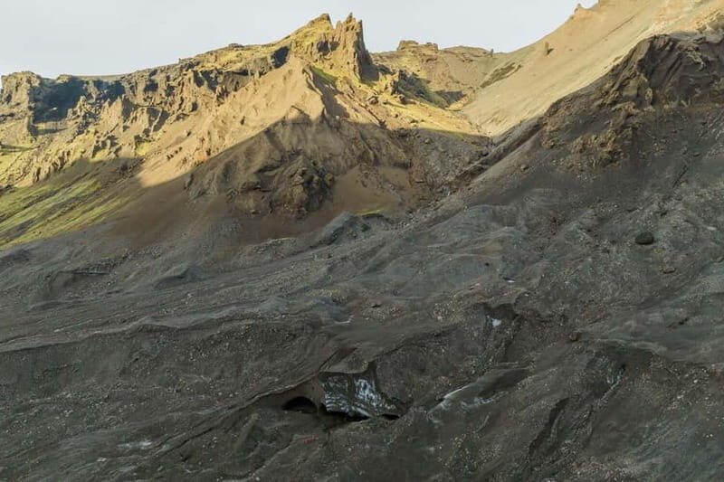
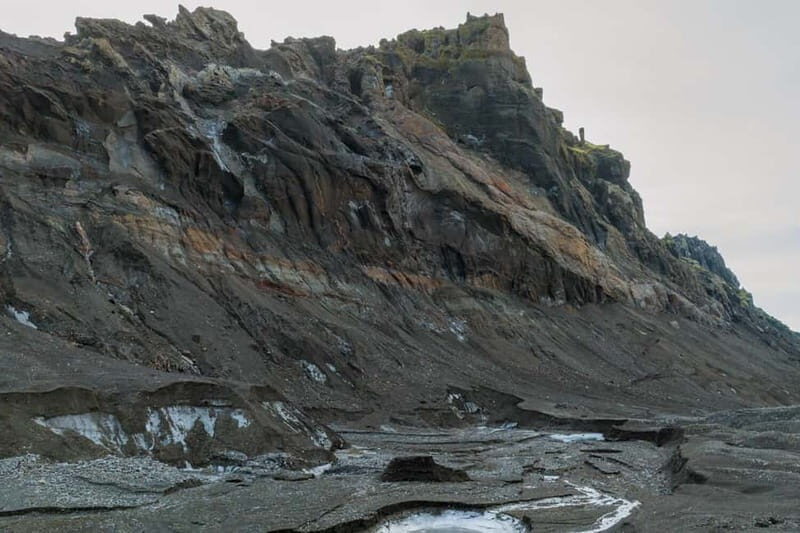
Driving through Thorsmork is a highlight in itself. This valley, also called the “Valley of Thor,” is famed for its vibrant colors, glacier-fed rivers, and mountains that seem to rise around you. The landscape is constantly changing, shaped by volcanic activity and glacial movements, making it a living textbook of Icelandic geology.
The hike into the canyon is designed to be accessible but still offers a sense of adventure. The route takes you into a quiet, hidden corner of the highlands, far from the busy tourist spots. Guides emphasize safety and teach you about glacier features like dead ice formations—large chunks of ice that have broken off and are slowly melting away. These formations are both eerie and beautiful, providing a tangible connection to the glacier’s ongoing transformation.
Expect to spend some time exploring around the glacier itself—learning how the terrain has formed, what signs of change to look for, and understanding the glacier’s role within the larger Katla Geopark framework. The guides are knowledgeable and passionate, eager to share their insights and answer questions along the way.
Scientific Contribution and What You’ll Take Home
One of the main attractions here is the opportunity to become a Citizen Scientist. Your mapping efforts help scientists understand the glacier’s current state—its size, shape, and ice features—and provide data for ongoing monitoring. This isn’t just a sightseeing trip; it’s an act of environmental stewardship.
After completing your mapping tasks, you’ll receive a Citizen Scientist Certificate from Katla Geopark, a nice acknowledgment of your contribution. Plus, the results of your efforts, along with ongoing updates, will be emailed to you afterward, so you can see how your participation fits into the bigger picture of glacier research.
This aspect makes the trip particularly meaningful for those interested in environmental issues, climate change, or scientific research. It’s an educational experience that leaves you with not just photos but a real sense of having contributed to important work.
Practical Details and Logistics
This full-day tour lasts about 10 hours, so be prepared for a long but fulfilling day. The start time varies based on availability, so it’s worth checking ahead. Transportation from Hvolsvöllur is included in the price, and the tour is exclusive to private groups, ensuring a personalized experience.
You’ll need to bring comfortable shoes, warm outdoor clothing, rain gear, and a packed lunch—all essential for comfort and safety. A camera is highly recommended to capture the incredible scenery and glacier features.
Since the terrain involves some moderate physical activity, this tour isn’t suitable for very young children, pregnant women, or those with mobility issues. The group size is limited to ensure safety and individual attention, and guides are experienced in handling varying weather conditions—be prepared for the unpredictable Icelandic weather.
Cost-wise, the value is in the combination of adventure, education, and contribution. The inclusion of equipment, training, transportation, and a certificate makes this a comprehensive package—especially for those who want a more engaged experience beyond sightseeing.
More Great Tours NearbyFinal Thoughts
This Krossárjökull Glacier Mapping Adventure isn’t for everyone, but for those who appreciate a mix of outdoor activity, scientific involvement, and stunning scenery, it’s a real gem. It offers a unique perspective on Iceland’s glaciers—showing that behind the icy beauty lies a world of change and importance.
We loved the way the guides combined expertise with genuine enthusiasm, making complex glacier science accessible and interesting. The drive through Thorsmork alone is worth the day, but add in the chance to actually walk on a glacier and contribute to climate monitoring? That’s a memorable experience.
If you’re curious about climate issues, enjoy active travel, and want an experience that feels impactful, this tour will tick those boxes. Keep in mind it’s a full day with some physical effort, but the views and the knowledge gained make it well worth it.
From Vik: Krossárjökull Glacier Mapping Adventure
FAQs
Is this tour suitable for children?
It’s not recommended for children under 10 due to the physical activity involved and safety considerations.
Do I need hiking experience?
No formal experience is required, but comfort with moderate activity and outdoor conditions is important.
What should I bring?
Wear comfortable hiking shoes, bring warm and rainproof outdoor clothing, water, a camera, and a packed lunch.
How long does the tour last?
The entire experience is about 10 hours, including travel and activities.
Is transportation included?
Yes, round-trip transportation from Hvolsvöllur in a 4×4 vehicle is included.
What kind of equipment do I use for mapping?
Basic glacier and mapping equipment are provided, and guides will give instructions on their use.
Will I get a certificate?
Yes, you’ll receive a Citizen Scientist Certificate from Katla Geopark upon completing the mapping.
Can I join on short notice?
Availability depends on weather and demand; booking early is recommended.
What if the weather is bad?
The guide team reserves the right to make changes for safety, including switching days or locations.
Is this suitable for people with mobility issues?
No, due to the hiking involved, it’s not suitable for those with mobility impairments.
This tour offers a rare peek into Iceland’s icy heart, combined with the chance to do something meaningful. If you’re after an adventure that leaves a mark—both literally and figuratively—this might be just what you’re looking for.
You can check availability for your dates here: